Worst Storms In Recent Memory – Our Top 5
I believe that we West Texans are lucky. Lucky because we haven't been hit by a major loss of life storm. Like the 1987 tornado that killed 30 and injured 121 of the 297 residents in the small West Texas town of Saragosa. If fact the only three fatalities in Taylor County that were caused by weather, all happened in separate storms decades apart. In 1985 one death caused by a tornado, in 1993 high wind claimed another and in the flash flood of 2007 claimed yet another. From 1950 to current date, in Taylor County alone, there have been 767 severe weather events causing over 110 million dollars in property damage and over 237 million dollars in crop damage. And the numbers keep climbing, because the official numbers from the April 2011 storms are not all in. Let's look at our "Worst Storms" by the sheer dollars in damage.

Droughts Are Costliest Storms

The Big Chill Freezes All Of West Texas

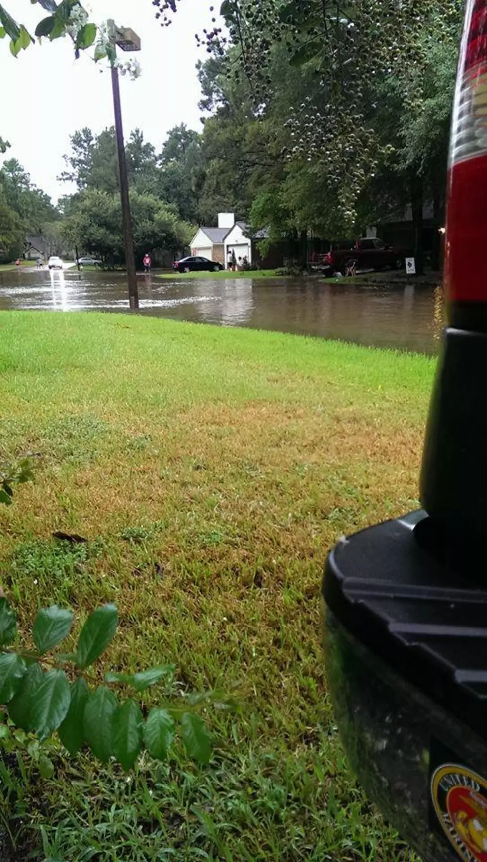
The Floods of 1994, 2000, 2002 and 2007
Flash Flooding has taken it's toll on the Big Country. Flooding alone has caused over 30 million dollars in property damage, and the totals for crop damage, come in just under 5 million dollars. the costliest flood occurred July 6th 2002. this flood cause over 15 million dollars in damage. It started as a tropical wave in south central Texas that moved north on into Taylor county around 3 AM on the 6th. Rainfall rates of 2 to 3 inches per hour produced rainfall amounts of up to 12 inches in the southern portions of Taylor county. A fire station on the south side of Abilene reported 5.2 inches of rain in less than 2 hours. The automated weather station at the Abilene airport reported 4 inches in 2 hours. The flooding throughout the county resulted in significant property damage with 31 homes destroyed, 339 receiving major damage, and 322 received minor damage. The tropical wave peaked in intensity during the early morning hours. However, numerous other thunderstorms developed across sections of Coleman and Brown Counties and into southern Callahan County, then spread west into the Abilene area. These new storms produced rainfall amounts of 10 to 14 more inches, adding to the already soaked creeks and lakes. Abilene received significant damage as the result of the heavy rains.

Baseball Sized, Hail To The Thunderstorms

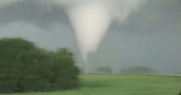
Tornadoes Are Just Blowing In The Wind
There has been, and still is, a lot of controversy as to whether it was a tornado or high winds that raced through our parking lot a couple months back. According to the National Oceanic Atmospheric Administration, there have only been a hand full of tornadoes in Abilene proper. As for the rest they were, really high winds. So both sides of the argument win. Nonetheless, over 17.7 million dollars damage has been caused by, both tornadoes and the wind. Tornadoes account for only 5 million dollars in destruction, the over 12 million dollars remaining goes to the wind. Winds estimated at 105 mph did extensive damage across Dyess AFB. Several buildings and 3 airplanes were severely damaged by the 100 mile plus winds. Scattered severe thunderstorms raced across the Big Country during the evening of July 12th 1998. The strongest storm moved in from Trent and Tye to Abilene, where winds over 100 mph ripped off roofs and downed power poles. Dyess Air Force Base took the brunt of the storm, with damage to buildings and airplanes totaling over 3 million dollars. The two most damaging tornadoes in Abilene were in 1976 and 1982 each caused 2.5 million dollars in damages totaling 5 million dollars. However, by the looks of the most recent videos, it appears tornadoes are coming more frequently.
More From KEAN 105


![Want to Survive the Texas Heat Without Air Conditioning? [Video]](http://townsquare.media/site/114/files/2023/06/attachment-We-should-always-check-on-the-elderly-and-reach-out-to-United-Way-for-assistance-Canva.jpg?w=980&q=75)


![[UPDATED] Six Bodies Found Inside a Family Van Are Late Singer’s Relatives](http://townsquare.media/site/194/files/2017/08/DIfey2GXkAEod_I.jpg?w=980&q=75)